Trail Walking Le Pradet - SityTrail - le Pradet les trois forts - Photo

SityTrail - le Pradet les trois forts

 affinetataille
affinetataille

User GUIDE

© OpenStreetMap contributors
Length
Length
12 km
Max alt
Max alt
285 m
Uphill gradient
Uphill gradient
458 m
Km-Effort
Km-Effort  
18.1 km
Min alt
Min alt
0 m
Downhill gradient
Downhill gradient
459 m
Boucle
Boucle
Yes
Creation date :
2021-01-17 17:05:38.927
Updated on :
2021-01-27 22:30:34.792

(1 Reviews)

Walking
Walking
5h30
Difficulty : Medium

Scan this QR Code to open this trail in the SityTrail application

FREE GPS app for hiking

Logo SityTrail SityTrail

IGN / Geographical institutes

Download SityTrail from the App Store Download SityTrail from Google Play

Logo SityTrail SityTrail World

The world is yours!

Download SityTrail from the App Store Download SityTrail from Google Play Download SityTrail on Huawei AppGallery

About

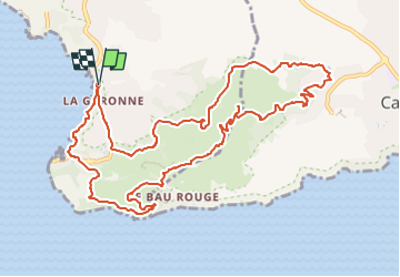
Trail Walking of 12 km to be discovered at Provence-Alpes-Côte d'Azur, Var, Le Pradet. This trail is proposed by affinetataille.

Description

La rando du jour: Le tour des 3 forts au Pradet.
Fort de La Bayarde - Fort de La Colle Noire - Fort de La Gavaresse.
Retour par le sentier des douaniers depuis la Mine de Cap Garonne jusqu'à la plage de La Garonne.
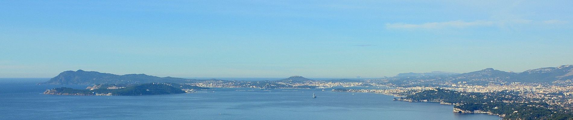
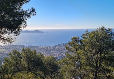
De magnifiques vues sur la presqu'ile de Giens et les Iles d'Hyères dans un premier temps, puis sur la Rade de Toulon (la plus belle de tout l'univers intergalactique) par la suite.
Passage le long des falaises du Bau Rouge pour continuer.
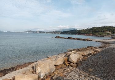
Retour enfin par le bord de mer entre le port des Oursinières et la plage de la Garonne.
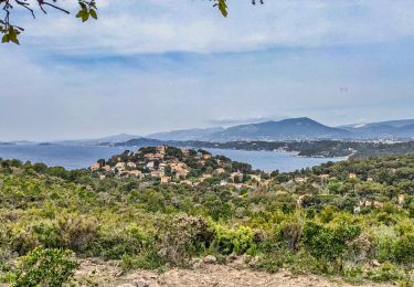
Une magnifique journée

Elevation profile

Photos

27 photos in total. Please click on a photo to see them all in the gallery.

Positioning

Country:
France
Region :
Provence-Alpes-Côte d'Azur
Department/Province :
Var
Municipality :
Le Pradet
Location:
Unknown
Start:(UTM)
257892 ; 4775426 (32T) N.

Comments

Please log in to post a review or rate the element


Trails nearby

Trail On foot Le Pradet - le pradet plage de la garonne la mine - Photo
On foot
chrifor

On foot

Easy
(1)
Le Pradet, Provence-Alpes-Côte d'Azur, Var, France
6.1 km | 8.2 km-effort
Unknown
Yes
Trail Cycle La Garde - piste cyclable la garde almanar hyeres - Photo
Cycle
francejpp

Cycle

Very easy
(1)
La Garde, Provence-Alpes-Côte d'Azur, Var, France
13.8 km | 15.1 km-effort
41min
No
Trail Walking Le Pradet - Les 3 forts-la Garonne-21-04-23 - Photo
Walking
Christiancordin

Walking

Medium
Le Pradet, Provence-Alpes-Côte d'Azur, Var, France
14.5 km | 21 km-effort
3h 56min
Yes
Trail Walking Le Pradet - pointe du baou rouge - Photo
Walking
famillerudent

Walking

Medium
Le Pradet, Provence-Alpes-Côte d'Azur, Var, France
6.8 km | 8.9 km-effort
2h 20min
Yes
Trail Walking La Garde - Le Plan-la Garde-24-03-23 - Photo
Walking
Christiancordin

Walking

Easy
La Garde, Provence-Alpes-Côte d'Azur, Var, France
6 km | 6.4 km-effort
1h 57min
Yes
Trail Walking Carqueiranne - la grotte du paradis  - Photo
Walking
cdanielrando

Walking

Easy
Carqueiranne, Provence-Alpes-Côte d'Azur, Var, France
3.9 km | 6.6 km-effort
1h 35min
Yes
Trail Walking Toulon - Autour du Mont Faron - Photo
Walking
ETMU5496

Walking

Difficult
Toulon, Provence-Alpes-Côte d'Azur, Var, France
22 km | 36 km-effort
5h 17min
Yes
Trail Walking Le Pradet - Fort de la Bayarde-06-05-22 - Photo
Walking
Christiancordin

Walking

Medium
(1)
Le Pradet, Provence-Alpes-Côte d'Azur, Var, France
12.4 km | 17.4 km-effort
3h 34min
Yes
Trail Walking Le Pradet - le Paradis  - Photo
Walking
GILOU440

Walking

Easy
Le Pradet, Provence-Alpes-Côte d'Azur, Var, France
12.6 km | 16.7 km-effort
3h 59min
No


Close
My subscriptions